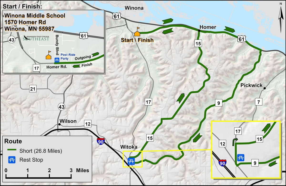
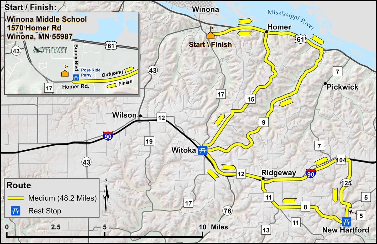
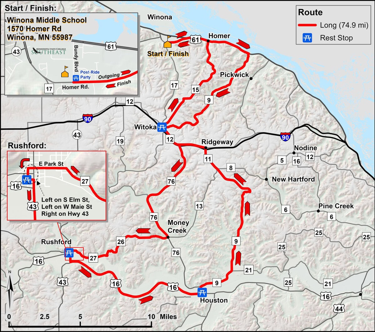
Ride your way with five unique routes and enjoy one of the most Minnesota bicycle rides of the year. Take it easy on our short trail or make it a challenge with the century! New this year is our gravel route for a different kind of ride. No matter what route you pick, you’ll be introduced to the wonderful scenery of the Mississippi River vistas, lush valleys and one-of-a-kind Driftless Region landscapes.
Full color maps and easy-to-read cue sheets will be provided in registration packets. Maps and signage for each route are color-coded as follows:
Note: The GPS maps show a portion of the route to Witoka as “Unpaved.” The Committee has inspected the road and determined that the surface is “Chip Sealed.” It employs a larger aggregate than blacktop but provides a very comfortable riding surface.
Routes are subject to change based on road construction, ongoing repairs, and unexpected events.
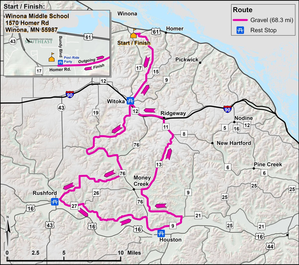
Gravel
69.8 Miles
7 segments of gravel, total gravel is approx. 41.5 miles
For route details and elevation information,
see the Interactive Map.
In the upper right corner of the Interactive Map there are two buttons to view a legend and to choose a basemap. If you click on a rest stop, a window will appear with the stop’s start and end time. Clicking on the “Home” button in the upper left will bring you back to the original view.


